
Growing volumes of aerial data
The sheer volume of available aerial data presents a significant challenge for analysts to exploit.
Indeed, this volume is growing exponentially, with 24.87 Pbit of data in 2020 and a forecast 52 Ebit of satellite data by 2029.
Rising new challenges
The space sector and new technologies are playing a major role in market opportunities, new use cases and new applications.rnrnToday, 58% of the world’s space economy is related to services for the general public, including players outside the space sector who rely heavily on satellite data for their commercial activities.
Various fields of application
The availability of aerial and spatial imagery enables the deployment of innovative solutions in a wide range of fields such as health, tourism, energy, agriculture, civil protection, insurance, transport, urban planning and many others.

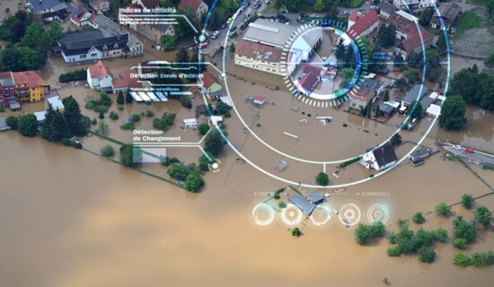
The challenge in interpreting data
Expert analysts need to become more efficient in interpreting raw data and allocating their workload for change detection in satellite images of a defined area. This analysis requires foolproof processing to achieve optimal operational decision-making.
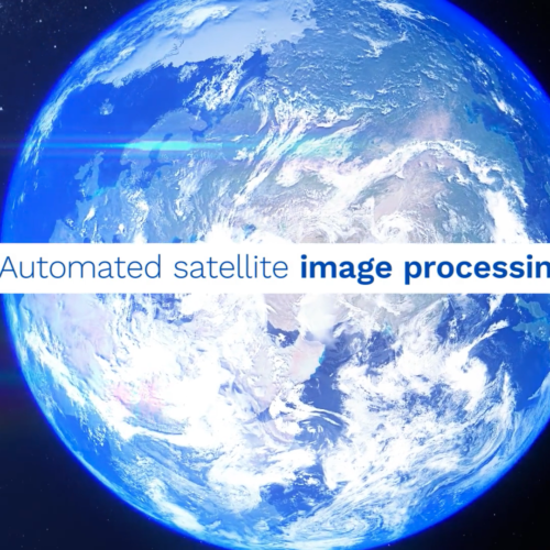
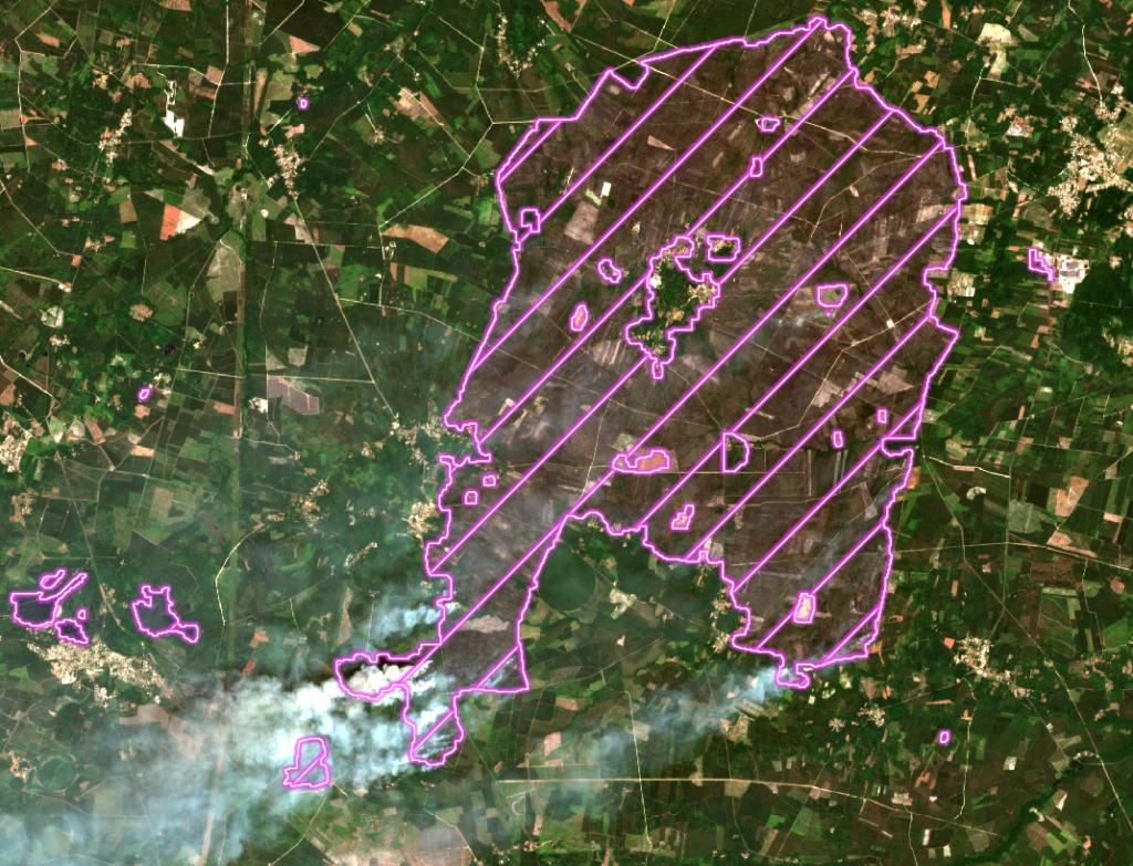
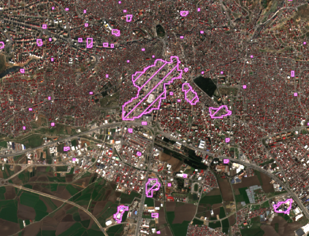
Computer vision for Earth observation :
Change detection in satellite imagery
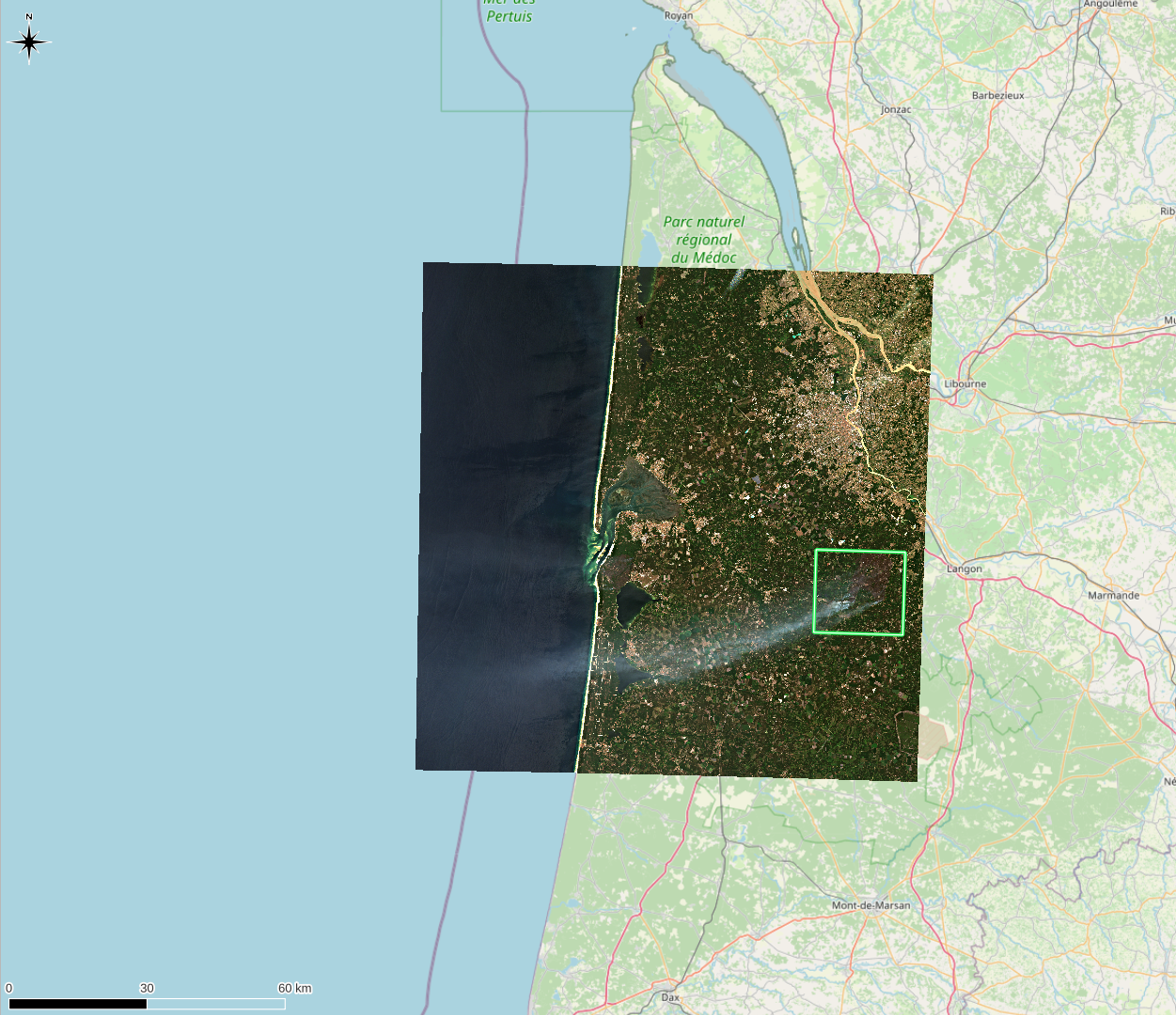
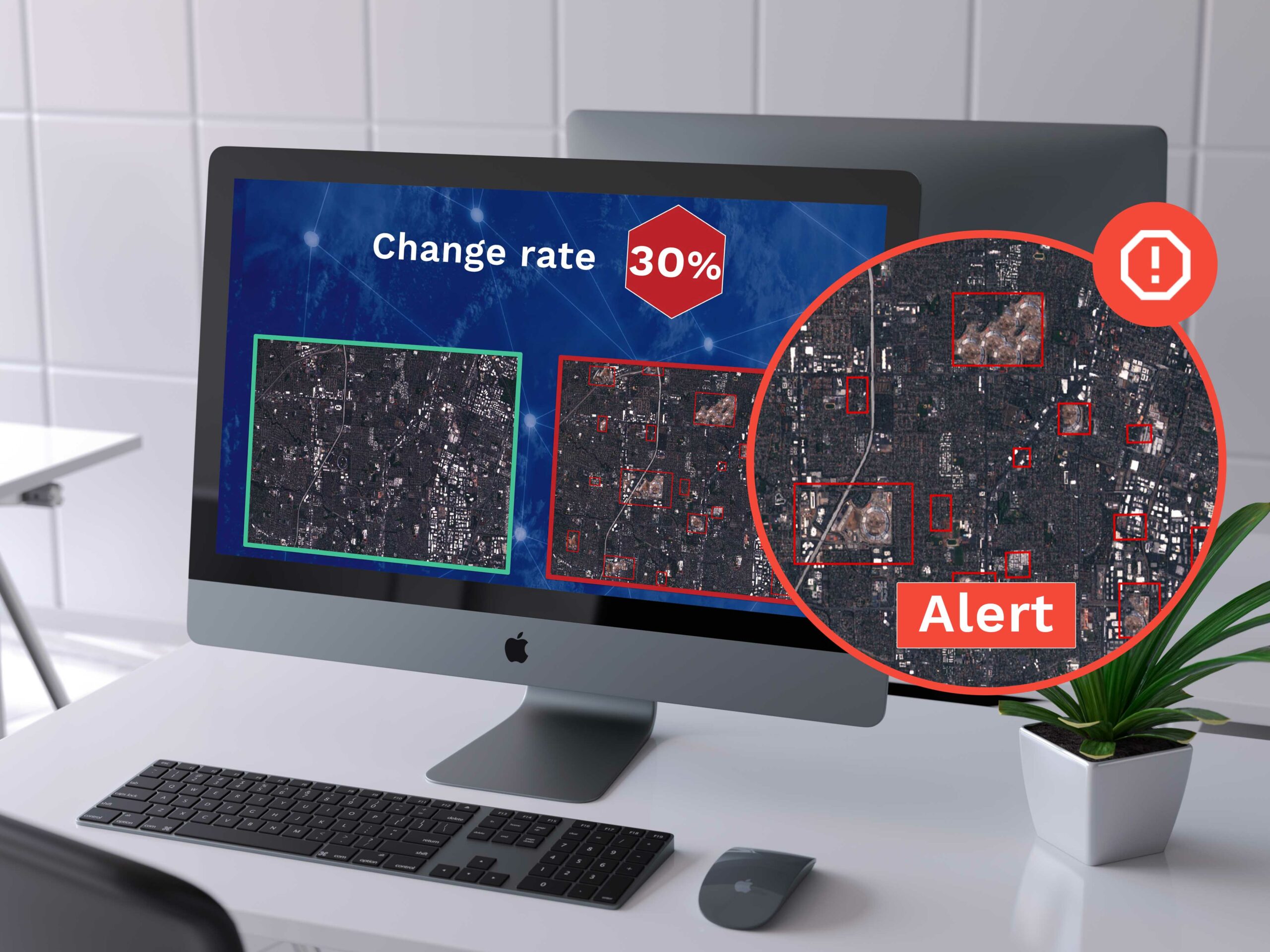
How does it work? The change detection in satellite images consists in processing a fine comparison between “n” images of a given area acquired from satellite constellations, and automatically analyses any change observed between T and T-n.rnrnWhen a change threshold (defined beforehand) is reached, an alert is generated by the EarthChange tool for expert analysts to qualify these variations and take necessary measures.
Make accessible optical and radar satellite image processing

Save time and increase efficiency
Change detection allows operators to focus their resources on detecting anomalies and changes, meaning expert analysts can reliably qualify the visual processing result.

A simplified approach
LTU serves as the missing link between providers of raw earth observation data and end users through a satellite image processing management tool.

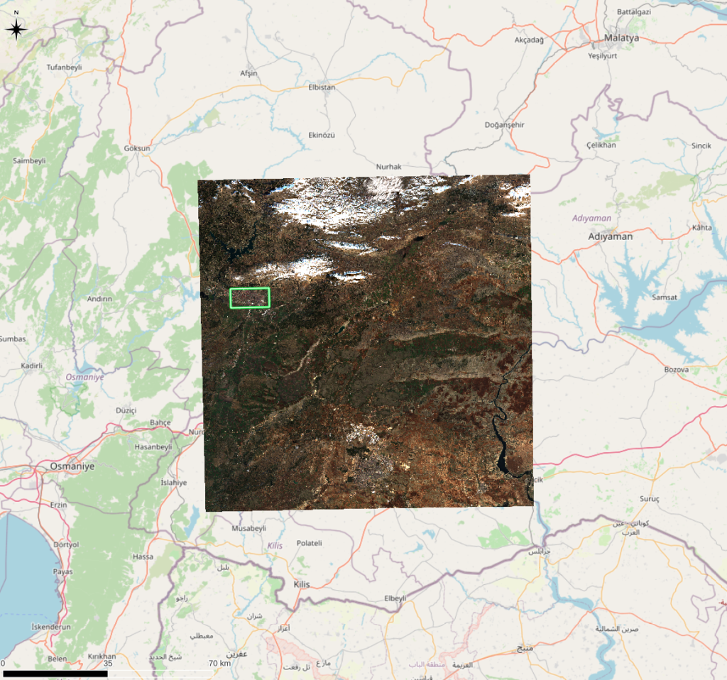
Real-time processing
This technology processes images collected by a satellite passing over a given area, and analyses in real time any change between flyovers.

No supervised learning
In opposition to most of computer vision technologies, LTU's processing of optical and radar satellite images is not carried out using Deep Learning with neural algorithms that are complex and expensive to implement, with unpredictable effectiveness.
Read our blog